While the Trails Illustrated map 105 is excellent for the trails, it does not include all the access roads you may need to use. We recommend that you obtain the Forest Service map of Pike National Forest for road travel the east side trailheads.
For the east side trailheads (Wigwam, Goose Creek), proceed SW on US285 to Pine Junction. Turn left (South) at Pine Junction on highway 126. Go through Pine Grove and Buffalo Creek to a long, straight section of steep pavement. At the bottom of this stretch, there is a paved parking lot for fishing access to Cheesman Reservoir and the road turns left along the stream. See other road information below for the Goose Creek trailhead.
South of the pavement, there are numerous places where people have pulled off the road to camp or picnic. Many of these places are approved for parking by the Forest Service and have a sign with a teepee on it. Places with no teepee signs are not approved.
Goose Creek Trailhead
It is 60 miles from the intersection of C470 and US-285. It has good pavement all the way to where highway 126 makes an abrupt turn east and you cross over Wigwam Creek. The first two miles are narrow and winding with limited visibility. There are some places where two vehicles cannot pass, but there are wider places nearby where you can pass. The next 12 miles are wide all-weather gravel road, at times dusty and washboarded. There are a couple of short, steep intervals which, when washboarded, require either 4WD or a good run at them with 2WD. The equestrian trailhead is about ¼ mile short of the hiker parking at the end of the road. Always park at the equestrian trailhead, as it may not be possible to turn around a rig at the hiker trailhead on a crowded weekend.
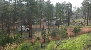 The access roads are not shown on the Trails Illustrated map 105, so if you have not been there before, we highly recommend you get the Pike National Forest map. With that map and a GPS track of where you have come, you should be able to make all the correct turns. This trailhead has four 12×12 foot pipe corrals and places for between 4 and 7 rigs, depending on how long the rigs are and whether they need to be parked on level ground. It is a great place to camp with horses. The Goose Creek trail is very popular with backpackers. On a fine weekend summer day, the hiker trailhead may be full capacity of about 70 vehicles and another 30 are parked along the adjacent access road. The equestrian trailhead is only occasionally used.
- Trails Accessed
- Goose Creek Trail 612. It is 12 miles round-trip to the intersection with the McCurdy Park trail 628. 612 is in good condition and presents no problems. From there it is 2 miles one-way on the McCurdy Park trail to the big boulder which presents an extreme hazard to horse travel. This stretch has some significantly eroded trail but is not really a hazard. From that same 612-628 intersection, it is 3 miles on 612 to Wigwam Park where the creek crossing is quite mucky and presents a crossing hazard. Early summer trail.
- Hankins Gulch Trail 630. It is 8 miles round-trip to Hankins Pass where it connects to the Lake Park Trail 639. Aside from a few short, steep rocky intervals, this is an easy trail. Early summer trail. The high point on the connecting Lake Park Trail 639 from Hankins Pass may have snow later and is more of a high summer trail.
Wigwam Trailhead
It is 55 miles from the intersection of C470 and US-285. The remarks on the access road for Goose Creek also apply here, you just make a different turn at a Y intersection. There is a nice dispersed equestrian campsite for 1 or possibly 2 rigs just short of the hiker trailhead. There are some other likely sites that will take more rigs further from the trailhead, but this needs further checking out.
- Trails Accessed
- Wigwam Trail east 609. It is 8 miles round trip to Wigwam Park. The trail is generally good. In the western part of Wigwam Park, there are some short steep parts and a place between boulders which is tight for a pack horse. We have never explored this short section. It might well be challenging but not too difficult. The western part of 609 we have cleared from Lost Park. In and around Wigwam Park it is a High summer trail.
Lost Park Camping
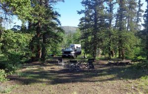
72 miles from the intersection of C470 and US-285 via the Lost Park Road. Or 80 miles via Jefferson, Route 77 and Rock Creek Hills Road. The first 1.5 miles of the Lost Park road (county maintained) seems to consist entirely of large cobblestones and is generally traversed at 10 to 15 mph. The remainder of the Lost Park Road to Rock Creek generally has a good deal of washboard after mid-June. The first half of the longer route is on the excellent pavement of Highway 77 and has an absurdly low speed limit. The Rock Creek Hills road is all-weather gravel and does not seem to have as much washboard as the Lost Park Road. From the top of Kenosha Pass, expect that it will take 1 to 1 ¼ hours to get to the camping place. If we go, we plan to camp overnight, often for 3 nights, arriving on Thursday afternoon to stake out our campsite. Our favorite camping place is about half a mile short of the Forest Service campground. It is a level place on the south (right) side of the road which will take 10 or 12 rigs comfortably and has scattered trees for highlines. GPS coordinates: 39.287153, 105.525074
 The F.S. campground does not allow horses but it has a loop where you can easily turn your rig around if you go too far. There are some other dispersed sites within a mile of the campground that are okay it not as ideal.
- Trails Accessed
- Brookside McCurdy 607 headed north. It is 19 miles round-trip to Craig Creek. The trail is very easy on the horses, but because it is long and not cleared each year, it may require a lot of clearing after the first 2 miles. Just short of Craig Creek there is a bog which is soft and about 2 feet deep, presenting an extreme hazard for horses. There is a fairly long bog-less way around this. Dan Shier has a GPS track for this. High summer trail.
- Brookside McCurdy 607 headed south. It is 7 miles round-trip to Ute Pass and the intersection with the Ute Creek trail 629. Early summer trail. Another mile one-way will bring you to the top of Bison Peak at timberline where we usually turn around.
- East Lost Park Trail to Wigwam Trail west 609. It is 16 miles round-trip to the upper end of Wigwam Park. The first 60% of the trail is through generally open level areas and prairie, so the clearing is in the eastern 40%. The trail is easy. See notes on the Wigwam east trail about a short, difficult area in upper Wigwam park where we have not passed. A high summer trail because of Lost Creek ford and high elevation of part of it near Wigwam Park.
Rock Creek Trailhead or Ben Tyler South Trailhead
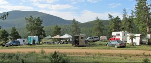
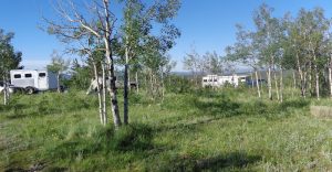
65 miles from the intersection of C470 and US-285 via the Lost Park Road. Or 73 miles via Jefferson, Route 77, and Rock Creek Hills Road. The first 1.5 miles of the Lost Park road (county maintained) seems to consist entirely of large cobblestones and is generally traversed at 10 to 15 mph. The remainder of the Lost Park Road to Rock Creek generally has a good deal of washboard after mid-June. The first half of the longer route via Jefferson is on paved Highway 77 and has a low speed limit. The Rock Creek Hills road is all-weather gravel and does not seem to have as much washboard as the Lost Park Road. The Rock Creek trailhead has good dispersed campsites for equestrians with good places for highlines and some protection from the wind and sun. The equestrian campsites are just short of the parking for the Colorado trail along the edge of the timber. They can accommodate up to 9 rigs, with more possible on the level prairie adjacent. GPS to the camping area in these pictures: 39.360394, -105.684945.
- Trails accessed
- Ben Tyler Trail south 606. It is 9 miles round-trip from the trailhead parking to the intersection with the Craig Park Trail 608 on top of the ridge. There is some rocky trail and a little bog about 1.5 miles from the trailhead, but the rest is an easy trail. The last part is across a level, dry willow flat where the trail is marked by a few posts, since there is no worn trail. The trail is easy enough to find northbound on the willow flat, but connecting going back can be tricky if you don’t have your northbound track on your GPS unit.
- Colorado Trail 1776, Segment 5. This trailhead puts you in the middle of the 14 mile Segment 5. FRBCH does not generally ride this trail as it is maintained by others.
Miller Gulch Trailhead
Update October 23, 2023 – There are no camping signs posted at the trail head.
From the intersection of C470 and US-285, travel south on US-285 to Pine Junction about 24.3 miles. Turn south or left at the stoplight onto Highway 126 or Pine Valley Road for about 18 miles going through Buffalo Creek. Turn right or west on Forest Service Road 550 or Redskin Creek Road. Travel about 6 or 7 miles west following the signs to Bailey. Keep to the right to the Miller Gulch trailhead. Do not go left towards Lake Wellington.
Another route is to go to Bailey on Highway 285. Turn left or south on Highway 68 at the bottom of the long downhill (Crow Hill). Follow the road south angling to the left to Forest Service Road 543. Follow the sign to the Miller Gulch trailhead. Do not go to Lake Wellington.
Twin Eagles Trailhead
From the intersection of C470 and US-285, travel south on US-285 for about 51 miles to County Road 77 in Jefferson. Turn left or south on County Road 77 or Tarryall Road and continue on for about 26.2 miles. Turn left onto the dirt road to the campground. GPS coordinates 39.152015, -105.478942.
The campground itself does not allow horses. When used by FRBCH members in 2010, there was a sizable level gravel area next to the campground where RV’s parked and suitable for equestrian camping, although not furnished with many trees for highlines. Since then, this and nearby Spruce Grove campground have been extensively reworked by the Forest Service and may be very different. This needs to be checked out.
- Trails Accessed
- Brookside/McCurdy trail 607, south end. 9 miles round-trip to the intersection with the Lake Park trail. 11 miles round-trip to McCurdy Park. A few rocky and steep places, but overall a good trail. High summer trail.